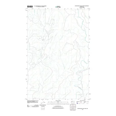
2011 Map of Wynoochee Valley NW
USGS Topo · Published 2011About this map
Wishkah River and Wynoochee River tributaries define this landscape in Grays Harbor County, showing the intricate drainage network of the Olympic Peninsula foothills. The map documents the industrial activity at Wishkah Quarry and the confluence of numerous water bodies, including West Fork Wishkah River, East Fork Wishkah River, and Big Creek. This 2011 survey captures the area's rural transportation corridors as they follow the natural river valleys, most notably along Wynoochee Valley Rd and Matzen Rd. Local landmarks and access points like Eagle Ln and Wheeler Rd provide specific geographical markers for local historians and researchers interested in the modern development of this river-fed timber and resource region.
Find a feature on this map
15 named features on this map. Tap any name to fly to it.
Don’t see what you’re looking for? This feature index may not catch every label — zoom into the map to look around manually.
Map Details
Editions of this 2011 Wynoochee Valley NW Map
This is the sole edition of this map. No revisions or reprints were ever made.
Other maps of this area

1921 · Quinault Lake
USGS Topo · 1:62,500

1921 · Satsop
USGS Topo · 1:62,500

1941 · Mobray
USGS Topo · 1:62,500

1943 · Humptulips
USGS Topo · 1:62,500

1943 · Mobray
USGS Topo · 1:62,500

1955 · Wynoochee Valley
USGS Topo · 1:62,500

1955 · Grisdale
USGS Topo · 1:62,500

1955 · Humptulips
USGS Topo · 1:62,500

1955 · Quinault Lake
USGS Topo · 1:62,500

1958 · Seattle
USGS Topo · 1:250,000