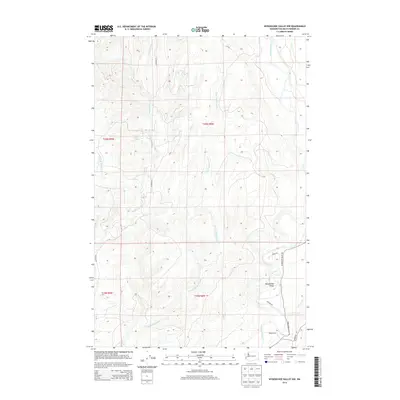
2014 Map of Wynoochee Valley NW
USGS Topo · Published 2014About this map
The Wynoochee River and Wishkah River drainages define this forested portion of the Olympic Peninsula foothills in the early twenty-first century. These two parallel river systems, separated by a high ridge, create a distinct north-south topographical orientation. The settlement at Wynoochee Valley is concentrated along the river corridor in the southeast, where Wynoochee Valley Rd and Matzen Rd provide access to the valley floor. To the west, the Wishkah Rd follows the Wishkah River, while numerous tributaries like Big Cr, the E Fork Wishkah River, and Parker Cr carve through the uplands. The presence of logging and access routes such as A6000 Rd and Wheeler Rd indicates the ongoing timber and rural character of the landscape within Township 20 North and Township 19 North.
Find a feature on this map
20 named features on this map. Tap any name to fly to it.
Don’t see what you’re looking for? This feature index may not catch every label — zoom into the map to look around manually.
Map Details
Editions of this 2014 Wynoochee Valley NW Map
This is the sole edition of this map. No revisions or reprints were ever made.
Other maps of this area

1921 · Quinault Lake
USGS Topo · 1:62,500

1921 · Satsop
USGS Topo · 1:62,500

1941 · Mobray
USGS Topo · 1:62,500

1943 · Humptulips
USGS Topo · 1:62,500

1943 · Mobray
USGS Topo · 1:62,500

1955 · Wynoochee Valley
USGS Topo · 1:62,500

1955 · Grisdale
USGS Topo · 1:62,500

1955 · Humptulips
USGS Topo · 1:62,500

1955 · Quinault Lake
USGS Topo · 1:62,500

1958 · Seattle
USGS Topo · 1:250,000