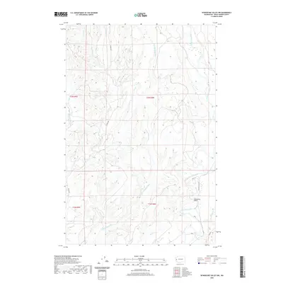
2020 Map of Wynoochee Valley NW
USGS Topo · Published 2020About this map
Wynoochee Valley anchors the southeastern portion of this landscape, where the Wynoochee River flows through a broad riparian corridor. The terrain is defined by a dense network of drainage systems, most notably the parallel southward courses of the Wishkah River and its various tributaries. The hydrology is highly articulated here, with the W Fork Wishkah River, E Fork Wishkah River, and smaller streams like Big Cr and Helm Cr carving through the uplifted topography. Transportation follows these natural contours, with Wishkah Rd tracing the western ridges and Wynoochee Valley Rd serving the eastern lowlands. This survey provides a clear view of the complex hydrography and rural infrastructure in Grays Harbor County at the start of the 2020s.
Find a feature on this map
18 named features on this map. Tap any name to fly to it.
Don’t see what you’re looking for? This feature index may not catch every label — zoom into the map to look around manually.
Map Details
Editions of this 2020 Wynoochee Valley NW Map
This is the sole edition of this map. No revisions or reprints were ever made.
Other maps of this area

1921 · Quinault Lake
USGS Topo · 1:62,500

1921 · Satsop
USGS Topo · 1:62,500

1941 · Mobray
USGS Topo · 1:62,500

1943 · Humptulips
USGS Topo · 1:62,500

1943 · Mobray
USGS Topo · 1:62,500

1955 · Wynoochee Valley
USGS Topo · 1:62,500

1955 · Grisdale
USGS Topo · 1:62,500

1955 · Humptulips
USGS Topo · 1:62,500

1955 · Quinault Lake
USGS Topo · 1:62,500

1958 · Seattle
USGS Topo · 1:250,000