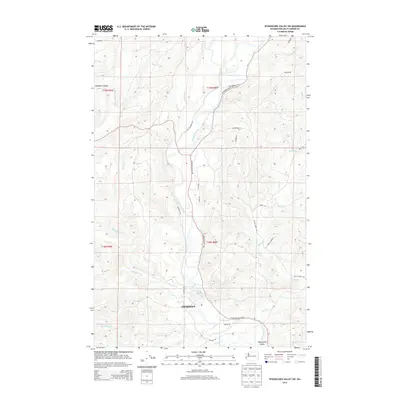
2014 Map of Wynoochee Valley SW
USGS Topo · Published 2014About this map
The Wynoochee River cuts a wide, meandering path through this portion of Grays Harbor County, defining the agricultural and residential corridor of the Wynoochee Valley. This 2014 survey captures the rural-urban interface as the northern outskirts of Aberdeen meet the timbered uplands and river bottomlands. The landscape is characterized by a dense network of drainages, including the E Fork Wishkah River and Wedekind Cr, which flow through the dissected terrain of Hamilton Canyon and the surrounding ridges.
Find a feature on this map
30 named features on this map. Tap any name to fly to it.
Don’t see what you’re looking for? This feature index may not catch every label — zoom into the map to look around manually.
Map Details
Editions of this 2014 Wynoochee Valley SW Map
This is the sole edition of this map. No revisions or reprints were ever made.
Other maps of this area

1940 · Montesano
USGS Topo · 1:62,500

1941 · Mobray
USGS Topo · 1:62,500

1943 · Humptulips
USGS Topo · 1:62,500

1943 · Mobray
USGS Topo · 1:62,500

1953 · Hoquiam
USGS Topo · 1:250,000

1955 · Montesano
USGS Topo · 1:62,500

1955 · Wynoochee Valley
USGS Topo · 1:62,500

1955 · Humptulips
USGS Topo · 1:62,500

1957 · Hoquiam
USGS Topo · 1:250,000
1957 · Aberdeen
USGS Topo · 1:24,000