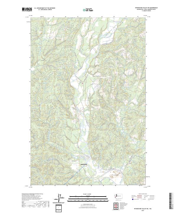
2023 Map of Wynoochee Valley SW
USGS Topo · Published 2023About this map
The Wynoochee River carves a winding path through this corner of Grays Harbor County, anchoring a landscape where river bottomlands meet the rising timbered ridges of the Wynoochee Valley. Near the southern edge of the survey, the northern reaches of Aberdeen appear along the banks of Wedekind Creek and Caldwell Creek, illustrating the city's inland expansion toward the valley floor. The map detail reflects a modern rural infrastructure defined by long-established timber and access routes like Wynoochee Valley Rd and Old Wynoochee Rd. Numerous smaller drainages, including Geisler Creek and Mooney Creek, create a complex hydraulic network that has historically dictated the placement of roads and homesteads. This 2023 edition documents the contemporary footprint of the valley just north of the Chehalis River confluence, showing how topography and water continue to shape the boundary between the urban edge and the coastal forest.
Find a feature on this map
30 named features on this map. Tap any name to fly to it.
Don’t see what you’re looking for? This feature index may not catch every label — zoom into the map to look around manually.
Map Details
Editions of this 2023 Wynoochee Valley SW Map
This is the sole edition of this map. No revisions or reprints were ever made.
Other maps of this area

1940 · Montesano
USGS Topo · 1:62,500

1941 · Mobray
USGS Topo · 1:62,500

1943 · Humptulips
USGS Topo · 1:62,500

1943 · Mobray
USGS Topo · 1:62,500

1953 · Hoquiam
USGS Topo · 1:250,000

1955 · Montesano
USGS Topo · 1:62,500

1955 · Wynoochee Valley
USGS Topo · 1:62,500

1955 · Humptulips
USGS Topo · 1:62,500

1957 · Hoquiam
USGS Topo · 1:250,000
1957 · Aberdeen
USGS Topo · 1:24,000