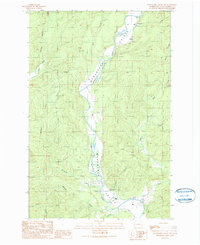
1990 Map of Wynoochee Valley SW
USGS Topo · Published 1990About this map
The Wynoochee Valley in Grays Harbor County is defined by the winding course of the Wynoochee River, as recorded in this 1990 provisional survey. Civil engineering and community infrastructure anchor the southern valley, featuring the Diversion Dam, a Pumping Station, and the Wynoochee Valley Grange Hall. These features suggest a landscape managed for both agriculture and water utility during the late twentieth century.
Find a feature on this map
23 named features on this map. Tap any name to fly to it.
Don’t see what you’re looking for? This feature index may not catch every label — zoom into the map to look around manually.
Map Details
Editions of this 1990 Wynoochee Valley SW Map
This is the sole edition of this map. No revisions or reprints were ever made.
Other maps of this area

1940 · Montesano
USGS Topo · 1:62,500

1941 · Mobray
USGS Topo · 1:62,500

1943 · Humptulips
USGS Topo · 1:62,500

1943 · Mobray
USGS Topo · 1:62,500

1953 · Hoquiam
USGS Topo · 1:250,000

1955 · Montesano
USGS Topo · 1:62,500

1955 · Wynoochee Valley
USGS Topo · 1:62,500

1955 · Humptulips
USGS Topo · 1:62,500

1957 · Hoquiam
USGS Topo · 1:250,000
1957 · Aberdeen
USGS Topo · 1:24,000