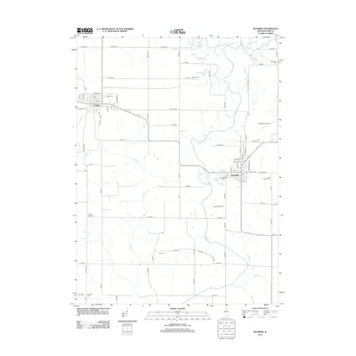
2012 Map of Wyoming
USGS Topo · Published 2012About this map
Toulon and Wyoming serve as the primary hubs in this corner of Stark County, where the agricultural landscape is defined by the wandering path of the Spoon River. This 2012 survey reveals a dense concentration of local heritage sites, particularly in its well-preserved cemeteries such as Toulon Cem, Saint Dominic Cem, and the uniquely named Snareville Cem. The terrain is drained by several seasonal watercourses including Indian Cr and Jug Run, reflecting the area's drainage patterns and farm-to-market road network. Aviation history is also represented by both Hausmann Airport and Wyoming Airport, highlighting the regional connectivity of these rural communities. For genealogists, the map is especially useful for locating outlying burial grounds like Mawbey Cem and Sheets Cem, which often represent earlier phases of 19th and 20th-century settlement.
Find a feature on this map
79 named features on this map. Tap any name to fly to it.
Don’t see what you’re looking for? This feature index may not catch every label — zoom into the map to look around manually.
Map Details
Editions of this 2012 Wyoming Map
This is the sole edition of this map. No revisions or reprints were ever made.
Other maps of this area

1893 · Dunlap
USGS Topo · 1:62,500

1898 · Dunlap
USGS Topo · 1:62,500

1932 · Dunlap
USGS Topo · 1:62,500

1933 · Dunlap
USGS Topo · 1:62,500

1933 · Camp Grove
USGS Topo · 1:48,000

1937 · Dunlap
USGS Topo · 1:62,500

1944 · Kewanee
USGS Topo · 1:62,500

1944 · Elmwood
USGS Topo · 1:62,500

1945 · Bradford
USGS Topo · 1:62,500

1948 · Elmwood
USGS Topo · 1:62,500