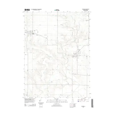
2015 Map of Wyoming
USGS Topo · Published 2015About this map
Toulon and Wyoming serve as the primary population centers in this Stark County landscape, connected by a network of rural roads and the winding course of the Spoon River. The terrain is defined by a significant number of localized burial grounds, including the County Farm Cem, Starwano Cem, and Mawbey Cem, which offer valuable points of reference for genealogists tracking early families in the region. The drainage patterns of Indian Cr and Jug Run carve through the agricultural lands, illustrating the traditional relationship between the area's watercourses and its settlement layout. Near the eastern edge, Hausmann Airport represents a more modern layer of transportation infrastructure, while the residential grids of the towns are meticulously detailed, showing streets such as Diagonal St and E Jefferson St. This 2015 data reflects the enduring character of these central Illinois communities, where local heritage is preserved in sites like Saint Dominic Cem and the Wyoming Cemetary.
Find a feature on this map
44 named features on this map. Tap any name to fly to it.
Don’t see what you’re looking for? This feature index may not catch every label — zoom into the map to look around manually.
Map Details
Editions of this 2015 Wyoming Map
This is the sole edition of this map. No revisions or reprints were ever made.
Other maps of this area

1893 · Dunlap
USGS Topo · 1:62,500

1898 · Dunlap
USGS Topo · 1:62,500

1932 · Dunlap
USGS Topo · 1:62,500

1933 · Dunlap
USGS Topo · 1:62,500

1933 · Camp Grove
USGS Topo · 1:48,000

1937 · Dunlap
USGS Topo · 1:62,500

1944 · Kewanee
USGS Topo · 1:62,500

1944 · Elmwood
USGS Topo · 1:62,500

1945 · Bradford
USGS Topo · 1:62,500

1948 · Elmwood
USGS Topo · 1:62,500