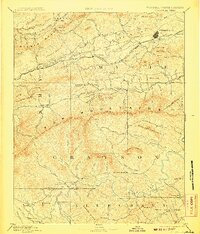
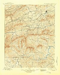
1892 Map of Wytheville
USGS Topo · Published 1907About this map
Wytheville serves as the focal point of this late 19th-century survey, situated along the Norfolk and Western Railroad as it cuts through the Great Valley between Pine Ridge and Sand Mountain. The landscape is defined by an industrial and agricultural economy, where iron production and milling are evident at sites like Speedwell Furnace, Eagle Furnace, and White Rock Furnace. Along the many watercourses, including Cripple Creek and the North Fork Holston River, early industry is marked by Tilson Mill and Kent Mill. To the south, across the high Iron Mountains, the settlement of Independence anchors the Grayson plateau near the New River. This map traces a transition from the rail-connected valley towns like Rural Retreat to the more isolated river outposts and post offices such as Mouth of Wilson and Weaversford P.O. near the Virginia North Carolina Boundary Line.
Find a feature on this map
119 named features on this map. Tap any name to fly to it.
Don’t see what you’re looking for? This feature index may not catch every label — zoom into the map to look around manually.
Map Details
Editions of this 1892 Wytheville Map
6 editions found

Other maps of this area

1887 · Pocahontas
USGS Topo · 1:125,000

1889 · Hillsville
USGS Topo · 1:125,000

1889 · Wytheville
USGS Topo · 1:125,000

1889 · Wilkesboro
USGS Topo · 1:125,000

1890 · Dublin
USGS Topo · 1:125,000

1891 · Tazewell
USGS Topo · 1:125,000

1891 · Pocahontas
USGS Topo · 1:125,000

1891 · Dublin
USGS Topo · 1:125,000

1891 · Abingdon
USGS Topo · 1:125,000

1891 · Wilkesboro
USGS Topo · 1:125,000