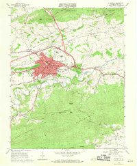
1968 Map of Wytheville
USGS Topo · Published 1970About this map
Wytheville sits at a critical junction of the Norfolk and Western railway and burgeoning interstate infrastructure, as evidenced by Interchange 21 and Interchange 22 encircling the town. This late 1960s survey documents a community serving as a regional hub for education and healthcare, anchored by the Wytheville Community College, the Wytheville Sanitarium and Hospital, and the Western Childrens Home. The town is framed by the steep slopes of Pine Ridge and the broad waters of Reed Creek.
Find a feature on this map
61 named features on this map. Tap any name to fly to it.
Don’t see what you’re looking for? This feature index may not catch every label — zoom into the map to look around manually.
Map Details
Editions of this 1968 Wytheville Map
4 editions found
Other maps of this area

1887 · Pocahontas
USGS Topo · 1:125,000

1889 · Hillsville
USGS Topo · 1:125,000

1889 · Wytheville
USGS Topo · 1:125,000

1890 · Dublin
USGS Topo · 1:125,000

1891 · Pocahontas
USGS Topo · 1:125,000

1891 · Dublin
USGS Topo · 1:125,000

1892 · Hillsville
USGS Topo · 1:125,000

1892 · Wytheville
USGS Topo · 1:125,000

1894 · Pocahontas
USGS Topo · 1:125,000

1895 · Pocahontas
USGS Topo · 1:125,000