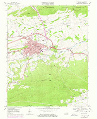
1968 Map of Wytheville
USGS Topo · Published 1978About this map
The town of Wytheville serves as the focal point of this late 1960s study, positioned at the foot of Pine Ridge and Sand Mountain. The map illustrates a community in transition, showing the newly constructed Interstate highway system via Interchange 21 and Interchange 22 cutting across the historical rail corridor established by the Norfolk and Western railroad. Educational and social institutions are prominent, from the Wytheville Community College campus to the Wytheville Sanitarium and Hospital and the Childrens Home. Outside the town center, the landscape is defined by the winding course of Reed Creek and the steep elevations of the Jefferson National Forest, where peaks like Queens Knob rise above peripheral settlements such as Haven and Petunia. The presence of numerous quarries and gravel pits along the mountain slopes points to the region's active industrial and mineral extraction history.
Find a feature on this map
75 named features on this map. Tap any name to fly to it.
Don’t see what you’re looking for? This feature index may not catch every label — zoom into the map to look around manually.
Map Details
Editions of this 1968 Wytheville Map
4 editions found
Other maps of this area

1887 · Pocahontas
USGS Topo · 1:125,000

1889 · Hillsville
USGS Topo · 1:125,000

1889 · Wytheville
USGS Topo · 1:125,000

1890 · Dublin
USGS Topo · 1:125,000

1891 · Pocahontas
USGS Topo · 1:125,000

1891 · Dublin
USGS Topo · 1:125,000

1892 · Hillsville
USGS Topo · 1:125,000

1892 · Wytheville
USGS Topo · 1:125,000

1894 · Pocahontas
USGS Topo · 1:125,000

1895 · Pocahontas
USGS Topo · 1:125,000