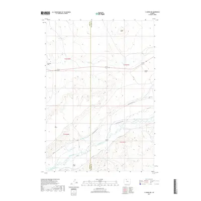
2017 Map of Y U Bench NE
USGS Topo · Published 2017About this map
The Greybull River valley serves as the lifeblood of this high-plains landscape, where an intricate network of historical irrigation infrastructure defines the region's agricultural character. This 2017 survey reveals the importance of water management in the Big Horn Basin, tracing the paths of the Keystone Ditch, Renner-Sims Ditch, and Himmerfield Ditch as they parallel the river's course. These man-made waterways support the valley floor between the elevated plateaus of Y U Bench and Emblem Bench. The small settlement of Fenton remains a central point in this rural expanse, connected by the Burlington Meeteetse Hwy. To the north, the terrain transitions toward more prominent landmarks like Bridger Butte and Red Point Draw, while the Bench Canal and Maller Ditch continue the legacy of reclamation that turned this arid environment into productive land.
Find a feature on this map
30 named features on this map. Tap any name to fly to it.
Don’t see what you’re looking for? This feature index may not catch every label — zoom into the map to look around manually.
Map Details
Editions of this 2017 Y U Bench NE Map
This is the sole edition of this map. No revisions or reprints were ever made.
Other maps of this area

1951 · Burlington
USGS Topo · 1:24,000

1951 · Y U Bench NW
USGS Topo · 1:24,000

1951 · Y U Bench NE
USGS Topo · 1:24,000

1951 · Sheep Mountain
USGS Topo · 1:24,000

1951 · Tatman Mountain
USGS Topo · 1:24,000

1951 · Sheets Flat
USGS Topo · 1:24,000

1955 · Cody
USGS Topo · 1:250,000

1958 · Cody
USGS Topo · 1:250,000

1962 · Cody
USGS Topo · 1:250,000

1966 · Gilmore Hill SE
USGS Topo · 1:24,000