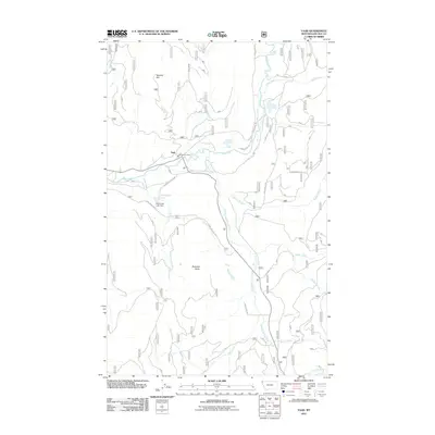
2011 Map of Yaak
USGS Topo · Published 2011About this map
The unincorporated community of Yaak sits at the confluence of the Yaak River and the South Fork Yaak River in this remote corner of northwest Montana. The landscape is defined by its complex drainage network and significant elevation changes, ranging from the banks of the rivers to peaks like Hensley Hill and Roderick Butte. Human activity is concentrated along the river valleys, where roads like River View Dr and S Fork Rd trace the water's path. Local landmarks such as the Yaak Vol Fire Dept and the Obermayer Lake Dam provide specific points of interest for those studying the infrastructure and settlement patterns of Lincoln County. The map details various timber-access routes and forest service roads, including Long Meadow Rd and Overdale Lodge Rd, which serve the dense woodlands surrounding smaller water bodies like Vinal Lake and Obermayer Lake.
Find a feature on this map
31 named features on this map. Tap any name to fly to it.
Don’t see what you’re looking for? This feature index may not catch every label — zoom into the map to look around manually.
Map Details
Editions of this 2011 Yaak Map
This is the sole edition of this map. No revisions or reprints were ever made.
Other maps of this area

1957 · Kalispell
USGS Topo · 1:250,000

1960 · Kalispell
USGS Topo · 1:250,000

1961 · Kalispell
USGS Topo · 1:250,000

1963 · Yaak
USGS Topo · 1:24,000

1963 · Sylvanite
USGS Topo · 1:24,000

1963 · Pink Mountain
USGS Topo · 1:24,000

1963 · Garver Mountain
USGS Topo · 1:24,000

1963 · Clark Mountain
USGS Topo · 1:24,000

1963 · Bonnet Top
USGS Topo · 1:24,000

1963 · Mount Henry
USGS Topo · 1:24,000