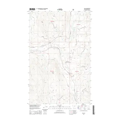
2014 Map of Yaak
USGS Topo · Published 2014About this map
The settlement of Yaak serves as the central point for this 2014 survey of Lincoln County, Montana. Located within the Kootenai National Forest, the area is defined by the high elevations of the Purcell Mountains and prominent peaks like Roderick Butte and Hensley Hill. The map detail follows the Yaak River and its major tributaries, including the S Fork Yaak River, tracing a landscape carved by numerous mountain streams such as Vinal Cr, Lang Cr, and Dutch Cr.
Find a feature on this map
41 named features on this map. Tap any name to fly to it.
Don’t see what you’re looking for? This feature index may not catch every label — zoom into the map to look around manually.
Map Details
Editions of this 2014 Yaak Map
This is the sole edition of this map. No revisions or reprints were ever made.
Other maps of this area

1957 · Kalispell
USGS Topo · 1:250,000

1960 · Kalispell
USGS Topo · 1:250,000

1961 · Kalispell
USGS Topo · 1:250,000

1963 · Yaak
USGS Topo · 1:24,000

1963 · Sylvanite
USGS Topo · 1:24,000

1963 · Pink Mountain
USGS Topo · 1:24,000

1963 · Garver Mountain
USGS Topo · 1:24,000

1963 · Clark Mountain
USGS Topo · 1:24,000

1963 · Bonnet Top
USGS Topo · 1:24,000

1963 · Mount Henry
USGS Topo · 1:24,000