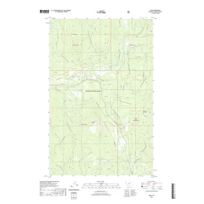
2020 Map of Yaak
USGS Topo · Published 2020About this map
The settlement of Yaak sits at a critical junction of mountain roads and watercourses in the northern reaches of the Kootenai National Forest. Located where the Yaak River meets the S Fork Yaak River, this area is defined by the high elevations of the Purcell Mountains and prominent peaks like Roderick Butte. The landscape is a network of forest development roads, such as Pipe Creek Rd and Yaak River Rd, which trace the valleys carved by Beaver Cr and Lang Cr. Significant water features like Vinal Lake and Obermayer Lake dot the higher terrain, while specialized routes like the Fowler Snowmobile (Snow) trail indicate the seasonal utility of this timber and recreation land. The surveying of large tract parcels, marked as various PB blocks, underscores the complex land management within this corner of Lincoln County.
Find a feature on this map
58 named features on this map. Tap any name to fly to it.
Don’t see what you’re looking for? This feature index may not catch every label — zoom into the map to look around manually.
Map Details
Editions of this 2020 Yaak Map
This is the sole edition of this map. No revisions or reprints were ever made.
Other maps of this area

1957 · Kalispell
USGS Topo · 1:250,000

1960 · Kalispell
USGS Topo · 1:250,000

1961 · Kalispell
USGS Topo · 1:250,000

1963 · Yaak
USGS Topo · 1:24,000

1963 · Sylvanite
USGS Topo · 1:24,000

1963 · Pink Mountain
USGS Topo · 1:24,000

1963 · Garver Mountain
USGS Topo · 1:24,000

1963 · Clark Mountain
USGS Topo · 1:24,000

1963 · Bonnet Top
USGS Topo · 1:24,000

1963 · Mount Henry
USGS Topo · 1:24,000