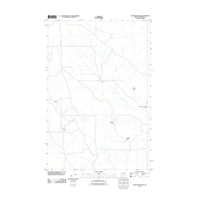
2011 Map of Yablonski Ranch
USGS Topo · Published 2011About this map
West Blacktail Creek meanders through this portion of Rosebud County, Montana, providing a focal point for the ranching and agricultural operations that define the area. The landscape is marked by several named water management features, including the Big Timber Number 7 Dam and the L Galt Number 19 Dam, which illustrate the critical importance of water conservation in this semiarid environment. This 2011 survey documents the presence of established homesteads and livestock operations, such as the Fox Homestead, Finch Ranch, and the eponymous Yablonski Ranch. These locations, connected by corridors like Gumbo Butte Rd and Edwards Rd, reflect the enduring patterns of rural Montana land use. The placement of small-scale dams like the J-K-Boyd Number 1 Dam indicates a decentralized approach to land and water management for private and shared agricultural needs.
Find a feature on this map
10 named features on this map. Tap any name to fly to it.
Don’t see what you’re looking for? This feature index may not catch every label — zoom into the map to look around manually.
Map Details
Editions of this 2011 Yablonski Ranch Map
This is the sole edition of this map. No revisions or reprints were ever made.
Other maps of this area

1954 · Forsyth
USGS Topo · 1:250,000

1957 · Forsyth
USGS Topo · 1:250,000

1958 · Forsyth
USGS Topo · 1:250,000

1960 · Yablonski Ranch
USGS Topo · 1:24,000

1960 · Ingomar West
USGS Topo · 1:24,000

1960 · Ingomar East
USGS Topo · 1:24,000

1960 · Black Sea Reservoir
USGS Topo · 1:24,000

1962 · Sumatra
USGS Topo · 1:24,000

1963 · Hecker Ranch
USGS Topo · 1:24,000

1963 · Regnal Coulee
USGS Topo · 1:24,000