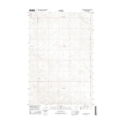
2017 Map of Yablonski Ranch
USGS Topo · Published 2017About this map
Yablonski Ranch stands as a focal point in this 2017 study of Rosebud County, Montana. The landscape is defined by the drainage patterns of W Blacktail Cr and Rattlesnake Cr, which carve through the high plains of the state's eastern region. This modern topographic view illustrates the enduring nature of large-scale ranching and the sparse infrastructure that supports it. Access to this territory is maintained by a limited network of gravel and primitive routes, including Gumbo Butte Rd, Hecker Rd, and N Ingomak Rd. These roads often follow the legal boundaries of the Public Land Survey System, which remains the primary framework for land management and ownership in this section of the Northern Plains.
Find a feature on this map
10 named features on this map. Tap any name to fly to it.
Don’t see what you’re looking for? This feature index may not catch every label — zoom into the map to look around manually.
Map Details
Editions of this 2017 Yablonski Ranch Map
This is the sole edition of this map. No revisions or reprints were ever made.
Other maps of this area

1954 · Forsyth
USGS Topo · 1:250,000

1957 · Forsyth
USGS Topo · 1:250,000

1958 · Forsyth
USGS Topo · 1:250,000

1960 · Yablonski Ranch
USGS Topo · 1:24,000

1960 · Ingomar West
USGS Topo · 1:24,000

1960 · Ingomar East
USGS Topo · 1:24,000

1960 · Black Sea Reservoir
USGS Topo · 1:24,000

1962 · Sumatra
USGS Topo · 1:24,000

1963 · Hecker Ranch
USGS Topo · 1:24,000

1963 · Regnal Coulee
USGS Topo · 1:24,000