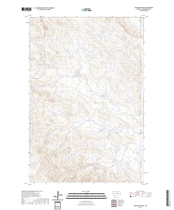
2024 Map of Yablonski Ranch
USGS Topo · Published 2024About this map
West Blacktail Creek meanders across this Rosebud County landscape, defining the drainage patterns of a region shaped by high plains topography. This modern U.S. Geological Survey topographic study reveals a terrain of complex coulees and ridges, largely organized by the Public Land Survey System as seen in the prominent township boundaries like t11n r34e. The limited road network, consisting of thoroughfares such as Gumbo Butte Rd and N Ingomak Rd, highlights the sparse settlement and open grazing character of this part of Montana. In the southern reaches of the quadrangle, Rattlesnake Creek cuts through the undulating ground, providing a crucial water source for the local ranching economy. This map serves as a precise guide to the contemporary land divisions and water courses that have dictated land use in this area for generations.
Find a feature on this map
9 named features on this map. Tap any name to fly to it.
Don’t see what you’re looking for? This feature index may not catch every label — zoom into the map to look around manually.
Map Details
Editions of this 2024 Yablonski Ranch Map
This is the sole edition of this map. No revisions or reprints were ever made.
Other maps of this area

1954 · Forsyth
USGS Topo · 1:250,000

1957 · Forsyth
USGS Topo · 1:250,000

1958 · Forsyth
USGS Topo · 1:250,000

1960 · Yablonski Ranch
USGS Topo · 1:24,000

1960 · Ingomar West
USGS Topo · 1:24,000

1960 · Ingomar East
USGS Topo · 1:24,000

1960 · Black Sea Reservoir
USGS Topo · 1:24,000

1962 · Sumatra
USGS Topo · 1:24,000

1963 · Hecker Ranch
USGS Topo · 1:24,000

1963 · Regnal Coulee
USGS Topo · 1:24,000