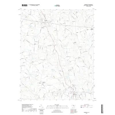
2019 Map of Yadkinville
USGS Topo · Published 2019About this map
Yadkinville serves as the central anchor for this part of Yadkin County, where the transition from town streets to the surrounding agricultural landscape is clearly defined by numerous family-named landmarks. The area's spiritual and genealogical history is anchored by several long-standing congregations and burial grounds, including the Center United Methodist Church Cem and the Deep Creek Friends Cem. Small private aviation facilities like Boonville Airport and Welborn Farm Airport dot the countryside, reflecting the local intersection of rural utility and regional transport.
Find a feature on this map
192 named features on this map. Tap any name to fly to it.
Don’t see what you’re looking for? This feature index may not catch every label — zoom into the map to look around manually.
Map Details
Editions of this 2019 Yadkinville Map
This is the sole edition of this map. No revisions or reprints were ever made.
Other maps of this area

1891 · Yadkinville
USGS Topo · 1:125,000

1893 · Yadkinville
USGS Topo · 1:125,000

1953 · Winston-Salem
USGS Topo · 1:250,000

1955 · Winston-Salem
USGS Topo · 1:250,000

1962 · Winston-Salem
USGS Topo · 1:250,000
1966 · Farmington
USGS Topo · 1:24,000
1966 · Lone Hickory
USGS Topo · 1:24,000

1966 · Yadkinville
USGS Topo · 1:24,000

1966 · East Bend
USGS Topo · 1:24,000
1970 · Siloam
USGS Topo · 1:24,000