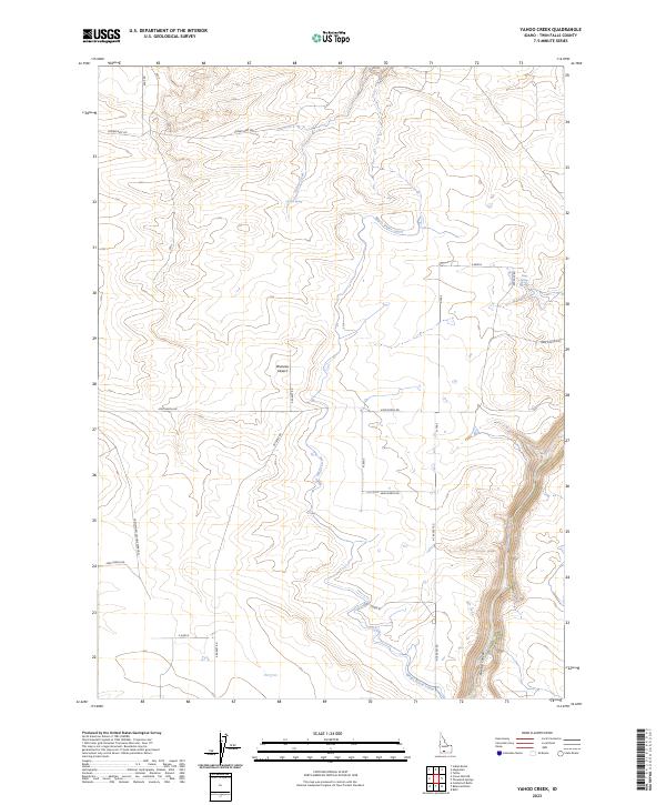
2023 Map of Yahoo Creek
USGS Topo · Published 2023About this map
Bruneau Desert terrain and the deep incision of Salmon Falls Creek define this portion of Twin Falls County. This modern survey illustrates the complex water management infrastructure essential to Idaho agriculture, notably the Magic Water Canal as it traverses the arid landscape between Yahoo Creek and the eastern canyon rim. The transition from the high desert plateau into the dramatic depths of Sinking Canyon provides a clear view of the region's geological character. Historically significant routes like Castleford Glenns Ferry Rd and Crows Nest Rd follow the section lines, connecting isolated water sources such as Coyote Spring and Rings Springs. The map serves as a precise record of how contemporary section roads and irrigation systems have been superimposed upon the natural drainage patterns of the high desert.
Find a feature on this map
27 named features on this map. Tap any name to fly to it.
Don’t see what you’re looking for? This feature index may not catch every label — zoom into the map to look around manually.
Map Details
Editions of this 2023 Yahoo Creek Map
This is the sole edition of this map. No revisions or reprints were ever made.
Other maps of this area

1949 · Pasadena Valley
USGS Topo · 1:62,500

1949 · Thousand Springs
USGS Topo · 1:24,000

1949 · Tuttle
USGS Topo · 1:24,000

1949 · Hagerman
USGS Topo · 1:24,000

1949 · Indian Butte
USGS Topo · 1:24,000

1950 · Hagerman
USGS Topo · 1:24,000
1950 · Indian Butte
USGS Topo · 1:24,000

1951 · Thousand Springs
USGS Topo · 1:24,000

1951 · Tuttle
USGS Topo · 1:24,000

1954 · Thousand Springs
USGS Topo · 1:24,000