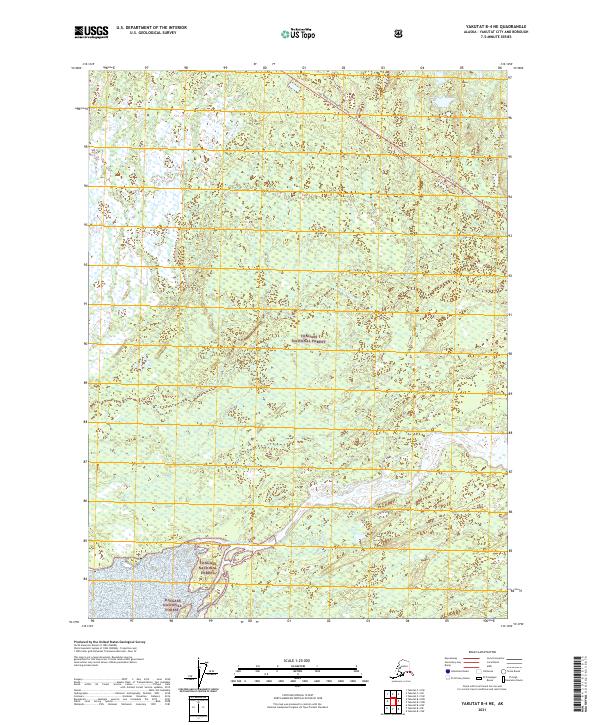
2021 Map of Yakutat B-4 NE
USGS Topo · Published 2021About this map
The Tongass National Forest dominates this Alaskan landscape, where the shifting hydrology of glacial outwash plains defines the terrain. The expansive Dangerous River and the Ahrnklin River create a complex network of braided channels and wetlands as they move toward the coast. A single terrestrial artery, the Yak. Road to Dangerous River, provides access into this remote section of the forest, reflecting the limited infrastructure of the Yakutat City and Borough. The map reveals a land primarily shaped by natural forces rather than permanent settlement, illustrating the wild, unpeopled character of the Dangerous River basin in the early 21st century. This survey is essential for understanding the contemporary topography of one of the nation's most significant protected wilderness areas.
Find a feature on this map
8 named features on this map. Tap any name to fly to it.
Don’t see what you’re looking for? This feature index may not catch every label — zoom into the map to look around manually.
Map Details
Editions of this 2021 Yakutat B-4 NE Map
This is the sole edition of this map. No revisions or reprints were ever made.
Other maps of this area

1951 · Yakutat
USGS Topo · 1:250,000

1959 · Yakutat C-3
USGS Topo · 1:63,360

1959 · Yakutat C-4
USGS Topo · 1:63,360

1959 · Yakutat B-3
USGS Topo · 1:63,360

1959 · Yakutat B-4
USGS Topo · 1:63,360

1959 · Yakutat
USGS Topo · 1:250,000

1987 · Yakutat C-4 SW
USGS Topo · 1:25,000
1987 · Yakutat C-4 SE
USGS Topo · 1:25,000
1987 · Yakutat B-4 NW
USGS Topo · 1:25,000
1997 · Yakutat C-4
USGS Topo · 1:63,360