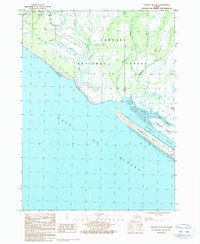
1987 Map of Yakutat B-5 NE
USGS Topo · Published 1988About this map
Tongass National Forest dominates the coastal landscape in this late-1980s survey, where the intricate hydrology of the Alaska coast meets the Gulf of Alaska. The map reveals a complex network of waterways, including Tawah Creek, Lost River, and the Situk River, which meander through tidal flats and marshes toward the sea. A significant geographic feature is the Blacksand Spit, a long coastal barrier separating the Ahrnklin River and Blacksand Island from the open ocean.
Find a feature on this map
18 named features on this map. Tap any name to fly to it.
Don’t see what you’re looking for? This feature index may not catch every label — zoom into the map to look around manually.
Map Details
Editions of this 1987 Yakutat B-5 NE Map
This is the sole edition of this map. No revisions or reprints were ever made.
Other maps of this area

1951 · Yakutat
USGS Topo · 1:250,000

1959 · Yakutat B-5
USGS Topo · 1:63,360

1959 · Yakutat C-5
USGS Topo · 1:63,360

1959 · Yakutat C-4
USGS Topo · 1:63,360

1959 · Yakutat B-4
USGS Topo · 1:63,360

1959 · Yakutat
USGS Topo · 1:250,000

1987 · Yakutat C-4 SW
USGS Topo · 1:25,000
1987 · Yakutat C-5 SE
USGS Topo · 1:25,000
1987 · Yakutat C-5 SW
USGS Topo · 1:25,000
1987 · Yakutat B-4 NW
USGS Topo · 1:25,000