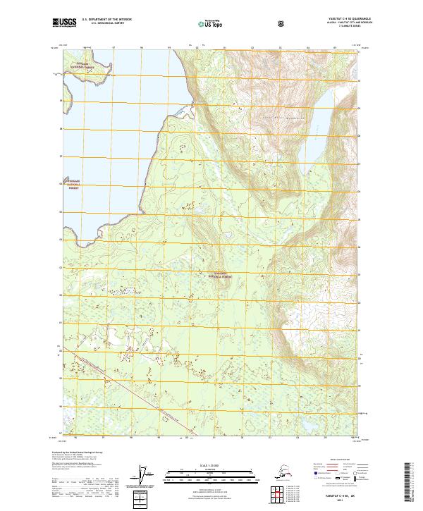
2021 Map of Yakutat C-4 SE
USGS Topo · Published 2021About this map
The coastal forests and foothills of the Tongass National Forest define this landscape along the Gulf of Alaska, where the southern reaches of the Saint Elias Mountains meet the sea. Near the prominent Cape Stoss, the map details a network of drainages and glacial outlets, including Beasley Creek and Seal Creek. The terrain transitions from these rugged uplands down to a complex wetland system in the south, characterized by smaller named watercourses such as Mickey, Lower 3 Fish, and 3 Fish Creek.
Find a feature on this map
18 named features on this map. Tap any name to fly to it.
Don’t see what you’re looking for? This feature index may not catch every label — zoom into the map to look around manually.
Map Details
Editions of this 2021 Yakutat C-4 SE Map
This is the sole edition of this map. No revisions or reprints were ever made.
Other maps of this area

1951 · Yakutat
USGS Topo · 1:250,000

1959 · Yakutat C-3
USGS Topo · 1:63,360

1959 · Yakutat C-4
USGS Topo · 1:63,360

1959 · Yakutat B-3
USGS Topo · 1:63,360

1959 · Yakutat B-4
USGS Topo · 1:63,360

1959 · Yakutat
USGS Topo · 1:250,000

1987 · Yakutat C-4 SW
USGS Topo · 1:25,000
1987 · Yakutat C-4 SE
USGS Topo · 1:25,000
1987 · Yakutat B-4 NW
USGS Topo · 1:25,000
1997 · Yakutat C-4
USGS Topo · 1:63,360