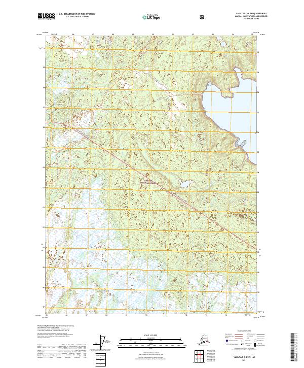
2021 Map of Yakutat C-4 SW
USGS Topo · Published 2021About this map
Tongass National Forest covers this coastal Alaskan terrain, where the complex hydrology of the Situk River and Old Situk River dominates the landscape. The map reveals a network of recreational and access routes, including the Yak. Road to Dangerous River and various specialized paths like the Ten-Mile-Bog Atv Route Trl. These trails imply a landscape used for seasonal subsistence and backcountry travel rather than permanent settlement.
Find a feature on this map
19 named features on this map. Tap any name to fly to it.
Don’t see what you’re looking for? This feature index may not catch every label — zoom into the map to look around manually.
Map Details
Editions of this 2021 Yakutat C-4 SW Map
This is the sole edition of this map. No revisions or reprints were ever made.
Other maps of this area

1951 · Yakutat
USGS Topo · 1:250,000

1959 · Yakutat B-5
USGS Topo · 1:63,360

1959 · Yakutat C-5
USGS Topo · 1:63,360

1959 · Yakutat C-4
USGS Topo · 1:63,360

1959 · Yakutat B-4
USGS Topo · 1:63,360

1959 · Yakutat
USGS Topo · 1:250,000

1987 · Yakutat C-4 SW
USGS Topo · 1:25,000
1987 · Yakutat C-4 SE
USGS Topo · 1:25,000
1987 · Yakutat C-5 SE
USGS Topo · 1:25,000
1987 · Yakutat B-5 NE
USGS Topo · 1:25,000