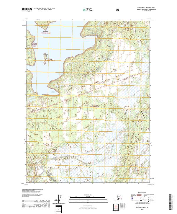
2021 Map of Yakutat C-5 SE
USGS Topo · Published 2021About this map
The coastal edge of the Tongass National Forest meets the Gulf of Alaska in this detailed survey of the terrain surrounding Yakutat. The landscape is defined by its complex shoreline, where Redfield Cove, Puerto de las Lanchas, and Sawmill Cove provide sheltered waters behind a series of small landforms including Dolgoi Island and Gregson Island. This area serves as a critical transportation corridor, anchored by the Yakutat Airport and the smaller Situk Airport further east.
Find a feature on this map
32 named features on this map. Tap any name to fly to it.
Don’t see what you’re looking for? This feature index may not catch every label — zoom into the map to look around manually.
Map Details
Editions of this 2021 Yakutat C-5 SE Map
This is the sole edition of this map. No revisions or reprints were ever made.
Other maps of this area

1951 · Yakutat
USGS Topo · 1:250,000

1959 · Yakutat B-5
USGS Topo · 1:63,360

1959 · Yakutat C-5
USGS Topo · 1:63,360

1959 · Yakutat C-4
USGS Topo · 1:63,360

1959 · Yakutat B-4
USGS Topo · 1:63,360

1959 · Yakutat
USGS Topo · 1:250,000

1987 · Yakutat C-4 SW
USGS Topo · 1:25,000
1987 · Yakutat C-5 SE
USGS Topo · 1:25,000
1987 · Yakutat B-5 NE
USGS Topo · 1:25,000
1987 · Yakutat C-5 SW
USGS Topo · 1:25,000