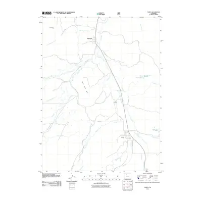
2011 Map of Yampa
USGS Topo · Published 2011About this map
Phippsburg and Yampa serve as the primary hubs in this Routt County corridor, where the valley floor is defined by the winding path of the Yampa River. The landscape reveals a sophisticated network of water management, illustrated by the North Hunt Creek Ditch, Palisades Ditch, and Burnt Mesa Ditch, which divert alpine flows to support local agriculture. The topography rises sharply at Devils Grave Mesa and Finger Rock, contrasting with the more industrial activity at the Seven Points Pit to the north.
Find a feature on this map
39 named features on this map. Tap any name to fly to it.
Don’t see what you’re looking for? This feature index may not catch every label — zoom into the map to look around manually.
Map Details
Editions of this 2011 Yampa Map
This is the sole edition of this map. No revisions or reprints were ever made.
Other maps of this area

1924 · Mt. Harris
USGS Topo · 1:48,000

1926 · Mount Harris
USGS Topo · 1:62,500

1954 · Craig
USGS Topo · 1:250,000

1957 · Craig
USGS Topo · 1:250,000

1958 · Craig
USGS Topo · 1:250,000

1960 · Craig
USGS Topo · 1:250,000

1962 · Craig
USGS Topo · 1:250,000

1964 · Craig
USGS Topo · 1:250,000

1965 · Craig
USGS Topo · 1:250,000
1966 · Sand Point
USGS Topo · 1:24,000