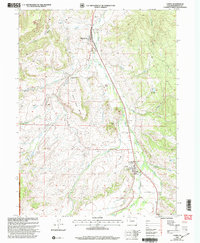
2000 Map of Yampa
USGS Topo · Published 2004About this map
The town of Yampa sits at the heart of this valley, serving as a gateway to the surrounding mountain landscape at the dawn of the 21st century. The map illustrates a developed corridor following the Yampa River, where human infrastructure like the Sewage Treatment Plant and the Yampa Ranger Sta meet the wilderness. To the north, the rail-oriented settlement of Phippsburg marks a distinct point in the transport network, while nearby Strip Mines indicate the industrial extraction occurring in the hills above Snake Creek.
Find a feature on this map
27 named features on this map. Tap any name to fly to it.
Don’t see what you’re looking for? This feature index may not catch every label — zoom into the map to look around manually.
Map Details
Editions of this 2000 Yampa Map
This is the sole edition of this map. No revisions or reprints were ever made.
Other maps of this area

1924 · Mt. Harris
USGS Topo · 1:48,000

1926 · Mount Harris
USGS Topo · 1:62,500

1954 · Craig
USGS Topo · 1:250,000

1957 · Craig
USGS Topo · 1:250,000

1958 · Craig
USGS Topo · 1:250,000

1960 · Craig
USGS Topo · 1:250,000

1962 · Craig
USGS Topo · 1:250,000

1964 · Craig
USGS Topo · 1:250,000

1965 · Craig
USGS Topo · 1:250,000
1966 · Sand Point
USGS Topo · 1:24,000