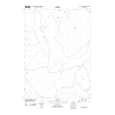
2010 Map of Yandell Springs
USGS Topo · Published 2010About this map
Yandell Mountain and the high basins of southeast Idaho dominate this landscape, which is defined by an intricate network of water sources and primitive transit routes. In this high-desert environment, the density of named springs—such as Dixey Spring, Cowboy Spring, and White Rock Spring—points to the critical importance of water management for local ranching and land use. The presence of Westvaco and the prominent Gay Mine Rd indicates the intersection of industrial logistics with the natural geography. This area is further shaped by the flow of Lincoln Creek and the Ross Fork, while the Farmer Ditch illustrates human efforts to divert water across the drainage basins of Danielson Basin and Sage Hen Basin. The survey also documents family and work routes like Jeff Cabin Rd and Pole Line Rd, which trace the high ridges and canyons.
Find a feature on this map
26 named features on this map. Tap any name to fly to it.
Don’t see what you’re looking for? This feature index may not catch every label — zoom into the map to look around manually.
Map Details
Editions of this 2010 Yandell Springs Map
This is the sole edition of this map. No revisions or reprints were ever made.
Other maps of this area

1937 · Pocatello
USGS Topo · 1:48,000

1940 · Blackfoot
USGS Topo · 1:62,500

1943 · Blackfoot
USGS Topo · 1:62,500

1944 · Pocatello
USGS Topo · 1:62,500

1951 · Higham Peak
USGS Topo · 1:24,000

1954 · Pocatello
USGS Topo · 1:250,000

1955 · Lincoln Creek
USGS Topo · 1:24,000

1955 · Yandell Springs
USGS Topo · 1:62,500

1955 · Idaho Falls
USGS Topo · 1:250,000

1958 · Idaho Falls
USGS Topo · 1:250,000