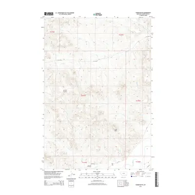
2014 Map of Yarger Butte
USGS Topo · Published 2014About this map
Yarger Butte rises as a prominent landmark in this segment of Powder River County, overseeing a landscape defined by an intricate network of drainage systems. The Powder River itself cuts through the southeastern corner, while smaller waterways like Sanders Cr, Cache Cr, and Yarger Cr carve through the surrounding terrain. This 2014 survey documents the sparse but vital human footprint in the region, centered on the Yarger Cem and a few established transit corridors like Cache Creek Rd and MT-391. The naming of features such as Dry Fork Fire Gulch and Fire Gulch suggests a landscape shaped by natural cycles of drought and flame, while the Public Land Survey System grid lines of t6s r49e and adjacent townships impose a formal order over the variable topography of eastern Montana.
Find a feature on this map
24 named features on this map. Tap any name to fly to it.
Don’t see what you’re looking for? This feature index may not catch every label — zoom into the map to look around manually.
Map Details
Editions of this 2014 Yarger Butte Map
This is the sole edition of this map. No revisions or reprints were ever made.
Other maps of this area

1954 · Ekalaka
USGS Topo · 1:250,000

1956 · Ekalaka
USGS Topo · 1:250,000

1958 · Ekalaka
USGS Topo · 1:250,000

1965 · Ekalaka
USGS Topo · 1:250,000

1966 · Sonnette
USGS Topo · 1:24,000

1966 · Hodsdon Flats
USGS Topo · 1:24,000

1970 · Baldy Peak
USGS Topo · 1:24,000

1970 · Bloom Creek
USGS Topo · 1:24,000

1970 · Huckins School
USGS Topo · 1:24,000

1973 · Lonesome Peak
USGS Topo · 1:24,000