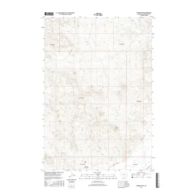
2017 Map of Yarger Butte
USGS Topo · Published 2017About this map
Yarger Cem stands as a significant historical marker in this drainage basin of the Powder River in southeastern Montana. The landscape is defined by the prominent Yarger Butte, which overlooks a complex network of intermittent watercourses including Cache Cr, Buck Cr, and Yarger Cr. This region of Powder River County reveals a classic western ranching landscape where development is tied to the water available in deep drainages like Dry Fork Fire Gulch and Fire Gulch. The sparse road network, consisting of Moorhead Rd and Big Powder River E Rd, emphasizes the rural, decentralized nature of the area. Land divisions across multiple townships, such as t6s r49e, show how early surveying shaped the distribution of ranch lands around these vital creek beds.
Find a feature on this map
25 named features on this map. Tap any name to fly to it.
Don’t see what you’re looking for? This feature index may not catch every label — zoom into the map to look around manually.
Map Details
Editions of this 2017 Yarger Butte Map
This is the sole edition of this map. No revisions or reprints were ever made.
Other maps of this area

1954 · Ekalaka
USGS Topo · 1:250,000

1956 · Ekalaka
USGS Topo · 1:250,000

1958 · Ekalaka
USGS Topo · 1:250,000

1965 · Ekalaka
USGS Topo · 1:250,000

1966 · Sonnette
USGS Topo · 1:24,000

1966 · Hodsdon Flats
USGS Topo · 1:24,000

1970 · Baldy Peak
USGS Topo · 1:24,000

1970 · Bloom Creek
USGS Topo · 1:24,000

1970 · Huckins School
USGS Topo · 1:24,000

1973 · Lonesome Peak
USGS Topo · 1:24,000