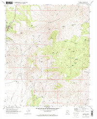
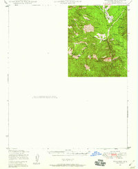
1969 Map of Yarnell
USGS Topo · Published 1973About this map
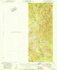
Yarnell sits tucked into the steep northern slopes of the Weaver Mountains, overlooking a landscape defined by an intensive mining history. This 1969 survey reveals a network of industrial sites concentrated around the Rich Hill area and the southern foothills, including the prominent Octave Mine and the Yarnell Mine. The terrain is deeply dissected by drainages such as Weaver Creek and Antelope Creek, which provided essential water sources for these operations through features like Millers Windmill and Bricks Windmill. Near the southern edge of the sheet, the settlement of Stanton marks a key historical node adjacent to the Devils Nest Mine and Myers Mine. The intricate web of Jeep Trails and Pack Trails threading through Lion Canyon and toward Wild Horse Mesa illustrates the rugged accessibility required for prospecting and ranching in this corner of Yavapai County.
Find a feature on this map
55 named features on this map. Tap any name to fly to it.
Don’t see what you’re looking for? This feature index may not catch every label — zoom into the map to look around manually.
Map Details
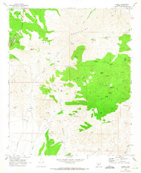
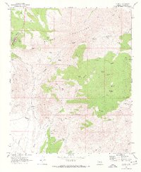
Editions of this 1969 Yarnell Map
3 editions found
Other maps of this area

1887 · Prescott
USGS Topo · 1:250,000

1892 · Prescott
USGS Topo · 1:250,000

1903 · Congress
USGS Topo · 1:125,000

1904 · Congress
USGS Topo · 1:125,000
1947 · Kirkland
USGS Topo · 1:62,500
1947 · Wagoner
USGS Topo · 1:62,500
1948 · Kirkland
USGS Topo · 1:63,360
1948 · Wagoner
USGS Topo · 1:63,360
1950 · Wagoner
USGS Topo · 1:62,500
1950 · Kirkland
USGS Topo · 1:62,500