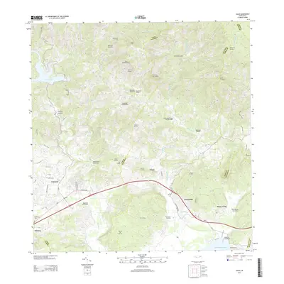
2013 Map of Yauco
USGS Topo · Published 2013About this map
Yauco and Guayanilla anchor this coastal and mountainous reach of southern Puerto Rico, where the southern foothills of the Central Mountain Range meet the Caribbean Sea. The landscape is defined by the steep elevation changes between summits like Pico Rodadero and Cerro de las Avispas and the fertile alluvial plains of the Rio Yauco and Rio Guayanilla. North of the urban centers, the reservoir at Lago Lucchetti stands as a significant hydrological landmark, fed by the Rio Naranjo and Rio Duey.
Find a feature on this map
52 named features on this map. Tap any name to fly to it.
Don’t see what you’re looking for? This feature index may not catch every label — zoom into the map to look around manually.
Map Details
Editions of this 2013 Yauco Map
This is the sole edition of this map. No revisions or reprints were ever made.
Other maps of this area

1937 · Sabana Grande
USGS Topo · 1:25,000

1938 · Guanica
USGS Topo · 1:30,000

1941 · Sabana Grande
USGS Topo · 1:30,000

1946 · Maricao
USGS Topo · 1:30,000

1946 · Punta Cuchara
USGS Topo · 1:30,000

1946 · Yauco
USGS Topo · 1:30,000

1946 · Monte Guilarte
USGS Topo · 1:30,000

1946 · Punta Verraco
USGS Topo · 1:30,000

1946 · Penuelas
USGS Topo · 1:30,000

1946 · Adjuntas
USGS Topo · 1:30,000