
1941 Map of Sabana Grande
USGS Topo · Published 1941About this map
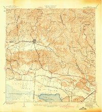
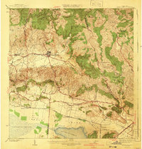
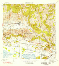
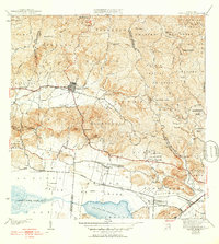
The settlement of Sabana Grande sits at a critical junction in southwest Puerto Rico, where the northern highlands meet the agricultural expanse of the Valle de Lajas. In the late 1930s, when these surveys were conducted, the region's economy was deeply tied to the American Railroad of Porto Rico, which serviced a string of stations including Estacion La Plata, Estacion Limon, and Estacion Santa Rita. The contrast between the drainage patterns of the northern hills, home to Pico Fraile and the headwaters of the Rio Guanajibo, and the southern wetlands near Laguna de Guanica and Cienaga el Anegado is starkly visible. Local life is anchored by landmarks like the Escuela Segunda Unidad de Minillas and the Iglesia de Sagrado Corazon de Jesus, reflecting a landscape defined by its municipal boundaries and river valleys.
Find a feature on this map
48 named features on this map. Tap any name to fly to it.
Don’t see what you’re looking for? This feature index may not catch every label — zoom into the map to look around manually.
Map Details
Editions of this 1941 Sabana Grande Map
5 editions found
Other maps of this area

1937 · San German
USGS Topo · 1:25,000

1937 · Sabana Grande
USGS Topo · 1:25,000

1938 · Guanica
USGS Topo · 1:30,000

1938 · Parguera
USGS Topo · 1:30,000

1941 · San German
USGS Topo · 1:30,000

1941 · Rosario
USGS Topo · 1:30,000

1942 · Rosario
USGS Topo · 1:30,000

1946 · Maricao
USGS Topo · 1:30,000

1946 · Yauco
USGS Topo · 1:30,000

1946 · Monte Guilarte
USGS Topo · 1:30,000
Featured Places
- Sabana Grande
- Sector Río Loco, Yauco
- Sector El Puente, Sabana Grande
- Sector Papayo, Sabana Grande
- Sector Facio, Yauco