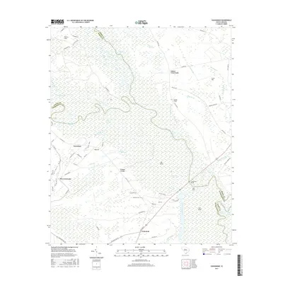
2017 Map of Yauhannah
USGS Topo · Published 2017About this map
Yauhannah and the confluence of the Great Pee Dee River and Little Pee Dee River define this lowcountry landscape at the border of Georgetown, Horry, and Marion Counties. The terrain is characterized by intricate river systems and expansive wetland tracts like Little Pee Dee Swamp and Cowford Swamp, where local geography is marked by family-named landmarks and historical crossings. Transport through these bottomlands relies on key points such as Yauhannah Bridge and Bradley Bridge, while settlements like Gilbert Crossroads and Rice Crossroads anchor the higher ground. Genealogists can locate the Yauhannah Cem and trace old family landholdings near Larrimore Gully or Petersfield. The map reveals a deeply hydrologic economy where features like Hell Gate and Bull Island emphasize the complexity of the river navigation and the winding course of Conch Creek.
Find a feature on this map
77 named features on this map. Tap any name to fly to it.
Don’t see what you’re looking for? This feature index may not catch every label — zoom into the map to look around manually.
Map Details
Editions of this 2017 Yauhannah Map
This is the sole edition of this map. No revisions or reprints were ever made.
Other maps of this area

1943 · Yauhannah
USGS Topo · 1:24,000

1943 · Bucksville
USGS Topo · 1:24,000

1943 · Carvers Bay
USGS Topo · 1:24,000

1943 · Brookgreen
USGS Topo · 1:24,000

1943 · Plantersville
USGS Topo · 1:24,000

1943 · Dongola
USGS Topo · 1:24,000

1943 · Conway
USGS Topo · 1:24,000

1943 · Outland
USGS Topo · 1:24,000

1944 · Outland
USGS Topo · 1:31,680

1946 · Johnsonville
USGS Topo · 1:62,500