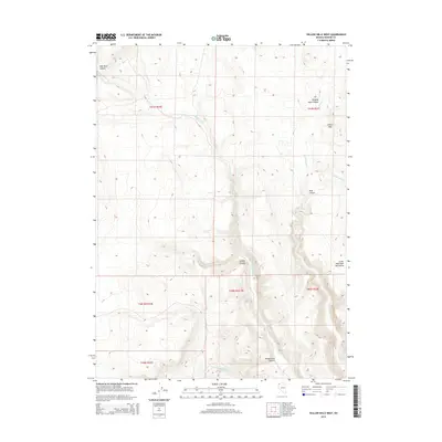
2015 Map of Yellow Hills West
USGS Topo · Published 2015About this map
High Rock Canyon and its associated drainage, High Rock Cr, dominate this high-desert landscape in northern Washoe County. This topographic survey captures the intricate canyon networks and varied terrain of the northwestern Great Basin, where seasonal watercourses like Wall Canyon Cr and Cottonwood Cr carve deep through the plateau. The map highlights the significant elevation shifts between the Yellow Hills and the Little High Rock Mountains, providing a detailed view of the natural corridors used by early travelers and surveyors through this region. Named landforms such as Hanging Rock Canyon and Grassy Canyon provide orientation points in a territory defined more by its geology than by human settlement. The inclusion of Section, Township, and Range lines, such as t41n r22e and t40n r23e, allows for precise location of land claims and historic survey points across the basins and draws.
Find a feature on this map
17 named features on this map. Tap any name to fly to it.
Don’t see what you’re looking for? This feature index may not catch every label — zoom into the map to look around manually.
Map Details
Editions of this 2015 Yellow Hills West Map
This is the sole edition of this map. No revisions or reprints were ever made.
Other maps of this area

1889 · Long Valley
USGS Topo · 1:250,000

1954 · Vya
USGS Topo · 1:250,000

1958 · Vya
USGS Topo · 1:250,000

1962 · Vya
USGS Topo · 1:250,000

1966 · Nut Mountain
USGS Topo · 1:24,000

1966 · Badger Mtn SE
USGS Topo · 1:24,000

1966 · Massacre Creek
USGS Topo · 1:24,000

1972 · Mahogany Mtn
USGS Topo · 1:24,000

1972 · High Rock Lake
USGS Topo · 1:24,000
1972 · Yellow Hills East
USGS Topo · 1:24,000