
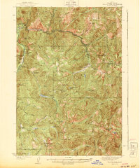
1943 Map of Yellow Pine
USGS Topo · Published 1943About this map
The Idaho National Forest landscape shown here, surveyed in the mid-1930s, reveals a remote mountain territory defined by its mineral wealth and isolated settlements. The village of Yellow Pine serves as the western gateway, while the mining outpost of Stibnite anchors the interior. This era was critical for strategic mineral extraction, as evidenced by the Antimony Mine and Cinnabar Mines near Monumental Summit.
Find a feature on this map
71 named features on this map. Tap any name to fly to it.
Don’t see what you’re looking for? This feature index may not catch every label — zoom into the map to look around manually.
Map Details
Editions of this 1943 Yellow Pine Map
2 editions found
Other maps of this area

1937 · Yellow Pine
USGS Topo · 1:48,000

1937 · Big Creek
USGS Topo · 1:48,000

1942 · Big Creek
USGS Topo · 1:62,500

1954 · Warm Lake
USGS Topo · 1:62,500

1956 · Elk City
USGS Topo · 1:250,000

1957 · Challis
USGS Topo · 1:250,000

1960 · Elk City
USGS Topo · 1:250,000

1960 · Challis
USGS Topo · 1:250,000

1961 · Greyhound Ridge
USGS Topo · 1:62,500

1961 · Chinook Mtn
USGS Topo · 1:62,500