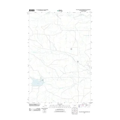
2011 Map of Yellow Water Reservoir
USGS Topo · Published 2011About this map
Yellow Water Reservoir and its associated water management infrastructure define the character of this Petroleum County landscape. Located in a region of Montana where water security is vital for ranching and agriculture, the reservoir is held by the Yellow Water Main Dam. The drainage network is shaped by the winding paths of McDonald Creek in the north and Elk Creek across the central portion, while Yellow Water Creek flows out from the reservoir's eastern edge. The map also records smaller-scale engineering improvements like the J King Number 1 Dam and J King Number 2 Dam, reflecting the importance of private or localized water control in the early 21st century. The sparse road network and lack of dense settlements emphasize the open, rural nature of this high plains territory.
Find a feature on this map
7 named features on this map. Tap any name to fly to it.
Don’t see what you’re looking for? This feature index may not catch every label — zoom into the map to look around manually.
Map Details
Editions of this 2011 Yellow Water Reservoir Map
This is the sole edition of this map. No revisions or reprints were ever made.
Other maps of this area

1954 · Roundup
USGS Topo · 1:250,000

1954 · Lewistown
USGS Topo · 1:250,000

1958 · Roundup
USGS Topo · 1:250,000

1959 · Lewistown
USGS Topo · 1:250,000

1986 · Snoose Creek
USGS Topo · 1:24,000

1986 · Flatwillow
USGS Topo · 1:24,000

1986 · Pike Creek Hills East
USGS Topo · 1:24,000

1986 · Winnett North
USGS Topo · 1:24,000

1986 · Crowley Dam
USGS Topo · 1:24,000

1986 · Teigen
USGS Topo · 1:24,000