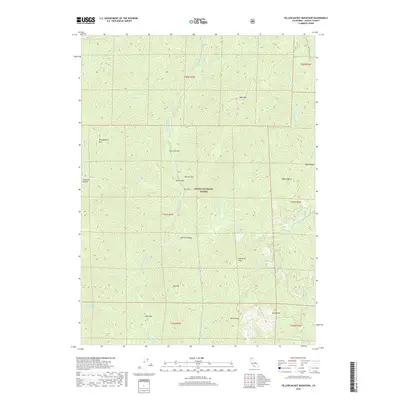
2018 Map of Yellowjacket Mountain
USGS Topo · Published 2018About this map
Shasta National Forest encompasses the high country of this 2018 survey, dominated by the McCloud River as it carves a path through the southern Cascades. The topography is defined by prominent summits such as Yellowjacket Mtn, Claiborne Peak, and Satin Peak. Flatlands amidst the steep drainage basins provide distinct landmarks, notably Peterson Flat, Garret Flat, and Pine Flat. These level areas likely served as important points of reference or activity in a landscape otherwise defined by deep drainages like Scorpion Gulch and Squaw Valley Cr. Human passage through the wilderness is marked by the Pacific Crest National Scenic Trail, which traverses the eastern ridgelines near Bald Mountain and Buck Ridge, providing a corridor for those navigating this complex mountain terrain.
Find a feature on this map
39 named features on this map. Tap any name to fly to it.
Don’t see what you’re looking for? This feature index may not catch every label — zoom into the map to look around manually.
Map Details
Editions of this 2018 Yellowjacket Mountain Map
This is the sole edition of this map. No revisions or reprints were ever made.
Other maps of this area

1886 · Shasta
USGS Topo · 1:250,000

1890 · Red Bluff
USGS Topo · 1:250,000

1894 · Red Bluff
USGS Topo · 1:250,000

1894 · Shasta
USGS Topo · 1:250,000

1901 · Redding
USGS Topo · 1:125,000

1935 · Dunsmuir
USGS Topo · 1:125,000

1946 · Lamoine
USGS Topo · 1:62,500

1948 · Weed
USGS Topo · 1:250,000

1949 · Bollibokka Mtn
USGS Topo · 1:62,500

1950 · Weed
USGS Topo · 1:250,000