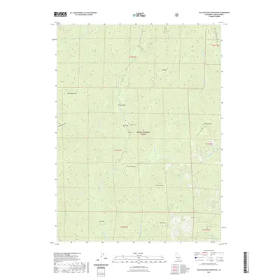
2021 Map of Yellowjacket Mountain
USGS Topo · Published 2021About this map
The McCloud River flows through this section of the Shasta National Forest in northern California, where the landscape is defined by its dramatic topographic relief and network of mountain streams. Several small flats and named bends suggest areas where the terrain levels off along the river, such as Peterson Flat, Garret Flat, and Hamilton Bend. These locations historically served as accessible points within the dense forest for travelers and local operations. High peaks like Yellowjacket Mtn, Bald Mtn, and Claiborne Peak ring the drainage basins of Squaw Valley Cr and Tom Neal Cr. For modern navigation and historical retracement, the map details the route of the Pacific Crest National Scenic Trl as it traverses the ridges, alongside local paths like the Cabin Creek Trl. The presence of named geographic features like Mule Shoe and Scorpion Gulch provides a glimpse into the local nomenclature used by foresters and early settlers in this remote part of Shasta County.
Find a feature on this map
39 named features on this map. Tap any name to fly to it.
Don’t see what you’re looking for? This feature index may not catch every label — zoom into the map to look around manually.
Map Details
Editions of this 2021 Yellowjacket Mountain Map
This is the sole edition of this map. No revisions or reprints were ever made.
Other maps of this area

1886 · Shasta
USGS Topo · 1:250,000

1890 · Red Bluff
USGS Topo · 1:250,000

1894 · Red Bluff
USGS Topo · 1:250,000

1894 · Shasta
USGS Topo · 1:250,000

1901 · Redding
USGS Topo · 1:125,000

1935 · Dunsmuir
USGS Topo · 1:125,000

1946 · Lamoine
USGS Topo · 1:62,500

1948 · Weed
USGS Topo · 1:250,000

1949 · Bollibokka Mtn
USGS Topo · 1:62,500

1950 · Weed
USGS Topo · 1:250,000