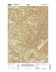
2014 Map of Yellowstone Mountain
USGS Topo · Published 2014About this map
Green Peter Lake dominates the southern reaches of this Linn County landscape, where the waters of Quartzville Creek and Moose Cr converge. The topography is defined by significant elevations, including Yellowstone Mountain and Crabtree Mtn, which rise above a network of deep drainages such as Packers Gulch and the many forks of Crabtree Cr. A single artery, Quartzville Rd, provides access through the valley, tracing the course of the creek as it winds past landmarks like Painter Falls and Cascade Falls. This map illustrates the intersection of industrial access and the natural hydrology of the Cascades, showing the relationship between high peaks like Harry Mtn and the reservoir system below. Smaller water bodies like Crabtree Lake remain tucked into high basins, while names like Gobblers Knob and Rocky Top ground the region's local nomenclature.
Find a feature on this map
31 named features on this map. Tap any name to fly to it.
Don’t see what you’re looking for? This feature index may not catch every label — zoom into the map to look around manually.
Map Details
Editions of this 2014 Yellowstone Mountain Map
This is the sole edition of this map. No revisions or reprints were ever made.
Other maps of this area

1929 · Mill City
USGS Topo · 1:125,000

1934 · Mc Kenzie Bridge
USGS Topo · 1:96,000

1940 · Mc Kenzie Bridge
USGS Topo · 1:125,000

1951 · Sweet Home
USGS Topo · 1:62,500

1951 · Snow Peak
USGS Topo · 1:62,500

1953 · Salem
USGS Topo · 1:250,000

1954 · Salem
USGS Topo · 1:250,000

1955 · Cascadia
USGS Topo · 1:62,500

1956 · Quartzville
USGS Topo · 1:62,500

1960 · Salem
USGS Topo · 1:250,000