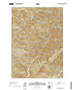
2020 Map of Yellowstone Mountain
USGS Topo · Published 2020About this map
Yellowstone Mtn and the surrounding high country of Linn County define this landscape, where steep drainages and isolated peaks rise above a network of forest roads. The area is defined by its dramatic hydrology, featuring Crabtree Lake in the north and the descending waters of Cascade Falls and Painter Falls further south. These cataracts feed into Quartzville Creek, which serves as a central artery for the local topography alongside Quartzville Dr. Historical timber and resource access is evident through established routes like Trout Creek Rd and Rocky Top Rd. Notable summits including Crabtree Mtn, Harry Mtn, and Gobblers Knob provide significant vertical relief, while numerous gulches like Packers Gulch and its South Fork carve deep into the terrain.
Find a feature on this map
32 named features on this map. Tap any name to fly to it.
Don’t see what you’re looking for? This feature index may not catch every label — zoom into the map to look around manually.
Map Details
Editions of this 2020 Yellowstone Mountain Map
This is the sole edition of this map. No revisions or reprints were ever made.
Other maps of this area

1929 · Mill City
USGS Topo · 1:125,000

1934 · Mc Kenzie Bridge
USGS Topo · 1:96,000

1940 · Mc Kenzie Bridge
USGS Topo · 1:125,000

1951 · Sweet Home
USGS Topo · 1:62,500

1951 · Snow Peak
USGS Topo · 1:62,500

1953 · Salem
USGS Topo · 1:250,000

1954 · Salem
USGS Topo · 1:250,000

1955 · Cascadia
USGS Topo · 1:62,500

1956 · Quartzville
USGS Topo · 1:62,500

1960 · Salem
USGS Topo · 1:250,000