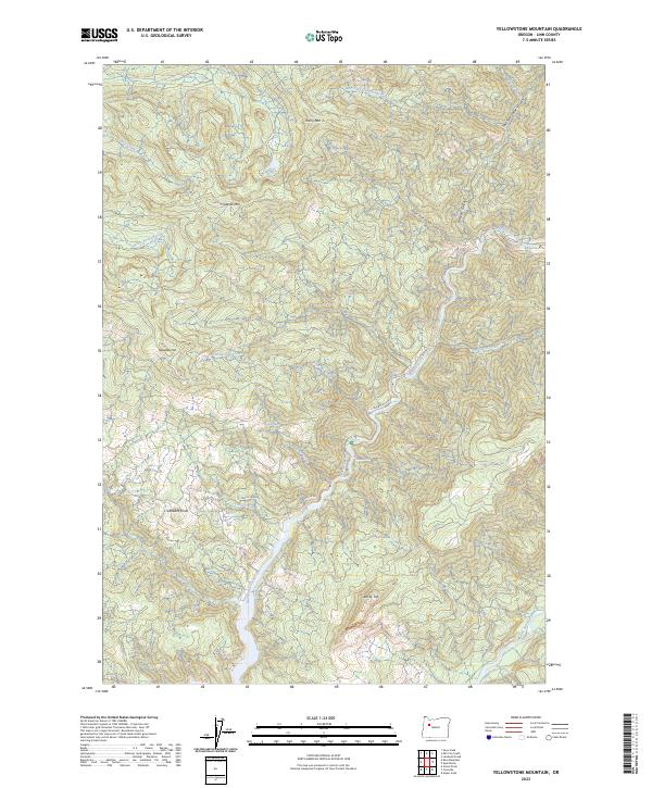
2023 Map of Yellowstone Mountain
USGS Topo · Published 2023About this map
Quartzville Creek Wild and Scenic River defines the central drainage of this Linn County landscape, where the Quartzville Creek flows through high-relief terrain marked by prominent peaks. The map reveals a network of high-elevation landmarks including Yellowstone Mountain, Harry Mountain, and Crabtree Mountain, while Gobblers Knob and Rocky Top stand as further evidence of the region's steep topography. This U.S. Geological Survey record indicates a landscape of dense water systems, including Crabtree Lake and the Middle Santiam River in the south. Transportation is limited to narrow corridors like Quartzville Drive and Rocky Top Road, highlighting the area's isolation. Water features dominate the northern section, where Crabtree Creek and Bonnie Creek drain the slopes, while Cascade Falls marks a notable drop along the Quartzville drainage.
Find a feature on this map
32 named features on this map. Tap any name to fly to it.
Don’t see what you’re looking for? This feature index may not catch every label — zoom into the map to look around manually.
Map Details
Editions of this 2023 Yellowstone Mountain Map
This is the sole edition of this map. No revisions or reprints were ever made.
Other maps of this area

1929 · Mill City
USGS Topo · 1:125,000

1934 · Mc Kenzie Bridge
USGS Topo · 1:96,000

1940 · Mc Kenzie Bridge
USGS Topo · 1:125,000

1951 · Sweet Home
USGS Topo · 1:62,500

1951 · Snow Peak
USGS Topo · 1:62,500

1953 · Salem
USGS Topo · 1:250,000

1954 · Salem
USGS Topo · 1:250,000

1955 · Cascadia
USGS Topo · 1:62,500

1956 · Quartzville
USGS Topo · 1:62,500

1960 · Salem
USGS Topo · 1:250,000