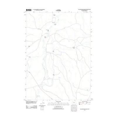
2012 Map of Yellowstone Ranch
USGS Topo · Published 2012About this map
Yellowstone Ranch and other established homesteads like Arthur Ranch and Henton Ranch anchor this landscape in Fremont County. The map details a sophisticated water management system crucial for high-plains agriculture, featuring the Samuel P Large Ditch, Auer Reservoir, and the vital flow of Beaver Cr. The terrain is deeply incised by numerous named draws, such as Government Slide Draw and Shearing Pen Draw, which illustrate the complex drainage patterns feeding into Cottonwood Cr. Transportation is defined by isolated routes like Beaver Creek Rd, while natural features such as Devils Gap Spring provide fixed points for livestock and travelers in this rangeland. This survey captures a moment in the modern ranching era where traditional land use meets contemporary mapping precision.
Find a feature on this map
19 named features on this map. Tap any name to fly to it.
Don’t see what you’re looking for? This feature index may not catch every label — zoom into the map to look around manually.
Map Details
Editions of this 2012 Yellowstone Ranch Map
This is the sole edition of this map. No revisions or reprints were ever made.
Other maps of this area

1953 · Ninemile Hill
USGS Topo · 1:24,000

1953 · Bringolf Ranch
USGS Topo · 1:24,000

1953 · Sweetwater Station
USGS Topo · 1:24,000

1953 · Sand Draw
USGS Topo · 1:24,000

1953 · Schlichting Mountain
USGS Topo · 1:24,000

1953 · Dishpan Butte
USGS Topo · 1:24,000

1953 · Del Monte Ridge
USGS Topo · 1:24,000

1953 · Yellowstone Ranch
USGS Topo · 1:24,000

1953 · Red Canyon
USGS Topo · 1:24,000

1955 · Lander
USGS Topo · 1:250,000