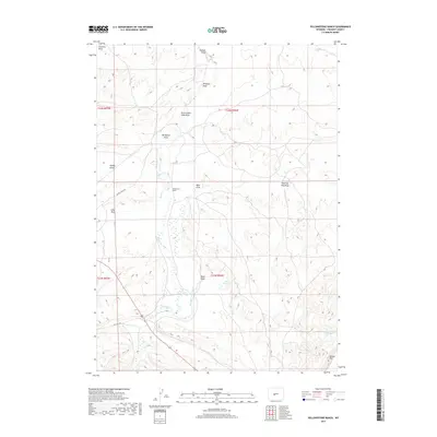
2017 Map of Yellowstone Ranch
USGS Topo · Published 2017About this map
Yellowstone Ranch sits at the heart of this high-desert landscape in Fremont County, where water management is the primary driver of settlement and land use. The presence of the Samuel P Large Ditch and the Auer Reservoir indicates the critical role of irrigation in sustaining ranching operations amidst a complex network of drainage features. The terrain is defined by numerous draws, including Government Slide Draw and McTurk Draw, which feed into Beaver Cr and Cottonwood Cr. These seasonal watercourses carve through the topography, leading toward the prominent southeastern overlook of Beaver Rim. Transportation in this modern era relies on routes such as Beaver Creek Rd and Old Hwy 789, connecting the ranch to the wider region. The map also identifies remote landmarks like Devils Gap Spring and Shearing Pen Draw, reflecting the specialized livestock industry that has long shaped this part of Wyoming.
Find a feature on this map
23 named features on this map. Tap any name to fly to it.
Don’t see what you’re looking for? This feature index may not catch every label — zoom into the map to look around manually.
Map Details
Editions of this 2017 Yellowstone Ranch Map
This is the sole edition of this map. No revisions or reprints were ever made.
Other maps of this area

1953 · Ninemile Hill
USGS Topo · 1:24,000

1953 · Bringolf Ranch
USGS Topo · 1:24,000

1953 · Sweetwater Station
USGS Topo · 1:24,000

1953 · Sand Draw
USGS Topo · 1:24,000

1953 · Schlichting Mountain
USGS Topo · 1:24,000

1953 · Dishpan Butte
USGS Topo · 1:24,000

1953 · Del Monte Ridge
USGS Topo · 1:24,000

1953 · Yellowstone Ranch
USGS Topo · 1:24,000

1953 · Red Canyon
USGS Topo · 1:24,000

1955 · Lander
USGS Topo · 1:250,000