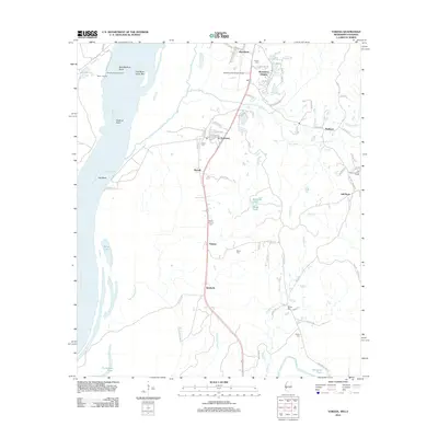
2012 Map of Yokena
USGS Topo · Published 2012About this map
The Mississippi River defines the western edge of this landscape, its shifting course evident in the broad arcs of Bedford Bend and Oak Bend. Inland, the settlement pattern follows the high ground between the river's alluvial plain and the interior drainage of Paces Bayou and Wrights Cr. Along the north-south transit corridor, local centers like Yokena, Kimberly, and Le Tourneau appear as focal points for the surrounding rural area. Genealogists will find several burial grounds distributed across the terrain, including Mount Giving Cem, Beard Cem, and Sadler Cem. The topography is marked by a transition from the level bottomlands near Paine Lake to the more dissected uplands near Warrenton Heights and the Vicksburg Municipal Airport in the north.
Find a feature on this map
81 named features on this map. Tap any name to fly to it.
Don’t see what you’re looking for? This feature index may not catch every label — zoom into the map to look around manually.
Map Details
Editions of this 2012 Yokena Map
This is the sole edition of this map. No revisions or reprints were ever made.
Other maps of this area

1909 · Mound
USGS Topo · 1:24,000

1910 · Mound
USGS Topo · 1:31,680

1918 · Vicksburg
USGS Topo · 1:62,500

1939 · Talla Bena
USGS Topo · 1:62,500

1939 · Yokena
USGS Topo · 1:62,500

1941 · Vicksburg
USGS Topo · 1:62,500

1955 · Jackson
USGS Topo · 1:250,000

1961 · Jackson
USGS Topo · 1:250,000

1962 · Jackson
USGS Topo · 1:250,000

1962 · Vicksburg West
USGS Topo · 1:24,000