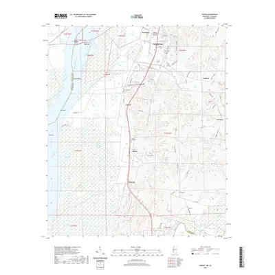
2020 Map of Yokena
USGS Topo · Published 2020About this map
The Mississippi River forms a complex boundary along the western edge of this landscape, where the Diamond Island Cutoff and significant bends like Bedford Bend and Oak Bend demonstrate the shifting nature of the river's path. Further east, the terrain transitions from low-lying wetlands and bayous, including Hennesseys Bayou and Paces Bayou, into the more elevated ridges where the settlements of Yokena, Le Tourneau, and Simrall are established. This topography historically influenced settlement patterns, concentrating population centers along north-south corridors like Glass Rd and away from the flood-prone Campbell Swamp.
Find a feature on this map
76 named features on this map. Tap any name to fly to it.
Don’t see what you’re looking for? This feature index may not catch every label — zoom into the map to look around manually.
Map Details
Editions of this 2020 Yokena Map
This is the sole edition of this map. No revisions or reprints were ever made.
Other maps of this area

1909 · Mound
USGS Topo · 1:24,000

1910 · Mound
USGS Topo · 1:31,680

1918 · Vicksburg
USGS Topo · 1:62,500

1939 · Talla Bena
USGS Topo · 1:62,500

1939 · Yokena
USGS Topo · 1:62,500

1941 · Vicksburg
USGS Topo · 1:62,500

1955 · Jackson
USGS Topo · 1:250,000

1961 · Jackson
USGS Topo · 1:250,000

1962 · Jackson
USGS Topo · 1:250,000

1962 · Vicksburg West
USGS Topo · 1:24,000