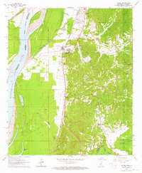
1963 Map of Yokena
USGS Topo · Published 1964About this map
The Illinois Central railroad corridor serves as the primary north-south artery through this stretch of Warren County, connecting a series of small riverside and trackside communities. Settlements like Yokena, Warrenton, and Le Tourneau (Glass) are situated along the alluvial plain, where the landscape is defined by the proximity of the Mississippi River and its accompanying Levee system. This area, surveyed in the early 1960s, reveals a dense network of local landmarks, including the Vicksburg Municipal Airport and numerous rural houses of worship such as Morning Star Ch and Immanuel Ch.
Find a feature on this map
38 named features on this map. Tap any name to fly to it.
Don’t see what you’re looking for? This feature index may not catch every label — zoom into the map to look around manually.
Map Details
Editions of this 1963 Yokena Map
4 editions found
Other maps of this area

1909 · Mound
USGS Topo · 1:24,000

1910 · Mound
USGS Topo · 1:31,680

1918 · Vicksburg
USGS Topo · 1:62,500

1939 · Talla Bena
USGS Topo · 1:62,500

1939 · Yokena
USGS Topo · 1:62,500

1941 · Vicksburg
USGS Topo · 1:62,500

1955 · Jackson
USGS Topo · 1:250,000

1961 · Jackson
USGS Topo · 1:250,000

1962 · Jackson
USGS Topo · 1:250,000

1962 · Vicksburg West
USGS Topo · 1:24,000