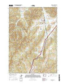
2017 Map of Yoncalla
USGS Topo · Published 2017About this map
Yoncalla serves as the primary hub in this Douglas County landscape, where the Yoncalla Valley meets the timbered slopes of DeVore Mtn and Skull Mtn. The 2017 survey reveals an area defined by its lumber heritage and hydraulic management, prominently featuring the Yoncalla Lumber Company Log Pond near the town center. To the south, Rice Hill and Rice Valley mark a transition in the terrain, where agricultural flats are interspersed with water resources like Weaver Reservoir and Thurman Weaver Reservoir. The map documents a complex network of canyons and passes, including Five Point Canyon, Blackberry Canyon, and Cougar Pass, which dictate the local transit routes. Local history is anchored at the Yoncalla Cem, while the surrounding hillsides are carved by numerous drainages such as Flagler Cr and Halo Cr, illustrating the rugged drainage patterns typical of the Umpqua River basin watershed.
Find a feature on this map
104 named features on this map. Tap any name to fly to it.
Don’t see what you’re looking for? This feature index may not catch every label — zoom into the map to look around manually.
Map Details
Editions of this 2017 Yoncalla Map
This is the sole edition of this map. No revisions or reprints were ever made.
Other maps of this area

1897 · Roseburg
USGS Topo · 1:125,000

1900 · Roseburg
USGS Topo · 1:125,000

1954 · Sutherlin
USGS Topo · 1:62,500

1954 · Drain
USGS Topo · 1:62,500

1954 · Anlauf
USGS Topo · 1:62,500

1954 · Glide
USGS Topo · 1:62,500

1958 · Roseburg
USGS Topo · 1:250,000

1959 · Roseburg
USGS Topo · 1:250,000

1979 · Roseburg
USGS Topo · 1:100,000

1979 · Cottage Grove
USGS Topo · 1:100,000