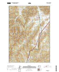
2020 Map of Yoncalla
USGS Topo · Published 2020About this map
Yoncalla sits at the northern end of a valley landscape dominated by the winding path of Yoncalla Cr and the Interstate 5 corridor. The town's layout is clearly defined by historical streets like Main St and Alder St, with the Yoncalla Cem situated on its western edge. The terrain is a complex arrangement of ridges and drainages, where named heights like Devore Mtn and Skull Mtn overlook narrow valleys.
Find a feature on this map
142 named features on this map. Tap any name to fly to it.
Don’t see what you’re looking for? This feature index may not catch every label — zoom into the map to look around manually.
Map Details
Editions of this 2020 Yoncalla Map
This is the sole edition of this map. No revisions or reprints were ever made.
Other maps of this area

1897 · Roseburg
USGS Topo · 1:125,000

1900 · Roseburg
USGS Topo · 1:125,000

1954 · Sutherlin
USGS Topo · 1:62,500

1954 · Drain
USGS Topo · 1:62,500

1954 · Anlauf
USGS Topo · 1:62,500

1954 · Glide
USGS Topo · 1:62,500

1958 · Roseburg
USGS Topo · 1:250,000

1959 · Roseburg
USGS Topo · 1:250,000

1979 · Roseburg
USGS Topo · 1:100,000

1979 · Cottage Grove
USGS Topo · 1:100,000