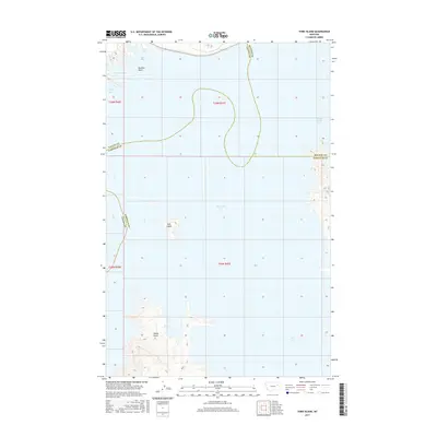
2017 Map of York Island
USGS Topo · Published 2017About this map
Fort Peck Lake dominates this landscape where the borders of Valley, McCone, and Garfield counties meet in central Montana. The complex shoreline of the reservoir is defined by numerous inlets and promontories, including Perch Bay and Sturgeon Bay to the north, and the expansive Dry Arm to the south. Landforms like Markles Point and Haxby Point provide distinct landmarks for navigating the water's edge, while York Island sits as a solitary landmass within the lake's expanse. The map illustrates the specialized topography of a reservoir-dominated environment, where the inundation of the Missouri River valley created a network of secondary bays such as Bear Creek Bay and Catfish Bay, fundamentally altering the geography of the three adjoining counties.
Find a feature on this map
16 named features on this map. Tap any name to fly to it.
Don’t see what you’re looking for? This feature index may not catch every label — zoom into the map to look around manually.
Map Details
Editions of this 2017 York Island Map
This is the sole edition of this map. No revisions or reprints were ever made.
Other maps of this area

1914 · Nashua
USGS Topo · 1:62,500

1916 · Nashua
USGS Topo · 1:62,500

1943 · Glasgow
USGS Topo · 1:125,000

1954 · Jordan
USGS Topo · 1:250,000

1954 · Glasgow
USGS Topo · 1:250,000

1956 · Jordan
USGS Topo · 1:250,000

1957 · Glasgow
USGS Topo · 1:250,000

1958 · Glasgow
USGS Topo · 1:250,000

1958 · Jordan
USGS Topo · 1:250,000

1958 · Sage Creek Point
USGS Topo · 1:24,000